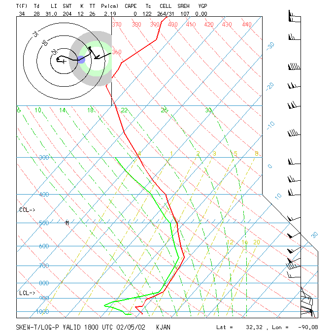
An isothermal layer is defined as a vertical column of air having a constant temperature with height. Isothermal layers often occur in the low levels of the troposphere during a differential advection situation. The image at the bottom of this Haby Hint shows an isothermal layer. Notice the temperature is near 0 C from the surface up to the 650 mb layer. That is one deep isothermal layer! IMPORTANCE TO WARM THICKNESS BIASING- An isothermal layer will cause a warm thickness biasing of the 1000 to 500 mb thickness. Thus, snow becomes more likely with 1000 to 500 mb thicknesses of 5,460 or even higher. Climatologically, there is a 50% chance precipitation will be snow if precipitation does occur at locations within 1,000 feet of sea level and the 5,400 gpm thickness line is overhead. The thickness can be higher in high elevation regions (average closer to 5,460 gpm) and have snow still occur since the earth's surface is closer the colder middle levels of the atmosphere. When an isothermal layer is present that is below freezing in the lower troposphere, the 50% chance snow 1000 to 500 mb thickness increases. This is because temperature is not cooling with height like would be normal through a deep layer. Thickness depends most on the average temperature in a layer of air. See webpage below for a complete discussion on thickness biasing. The 540 line and precipitation type IMPORTANCE TO STABILITY- The air within an isothermal layer is stable (lapse rate less than the MALR). To cause air in an isothermal layer to rise it must be forced lifted since it will not rise on its own from positive buoyancy. A deep isothermal layer will cause the Lifted Index (LI) and Showalter Index (SWI) to indicate very high stability since a rapid cooling with height is needed to create instability. 
|