
METEOROLOGIST JEFF HABY
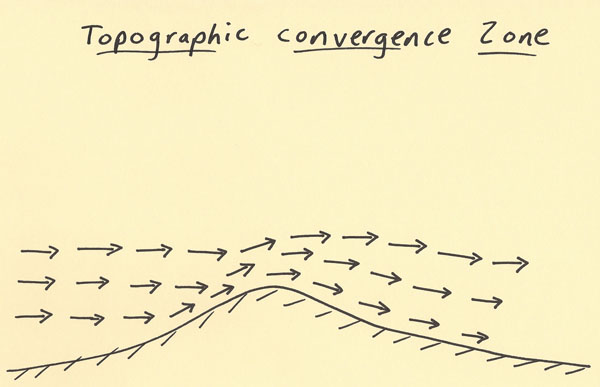
The diagram below shows a flow pattern over a region with an elevated terrain such as a rise of 1,500 feet. Where the wind is blowing
toward the peak, the air is compressed as it approaches the peak. This forces the air to rise. In an unstable situation, this lifting
can produce convective storms. In a winter situation, this lifting can produce heavier snow in the higher elevations. Regions such
as this are called topographic convergence zones. Topographic convergence will occur where the wind flow is forced up and around
a higher elevation region. This can initiate convective uplift and heavier precipitation around
the vicinity the air is forced to rise.
|
|
|