
METEOROLOGIST JEFF HABY
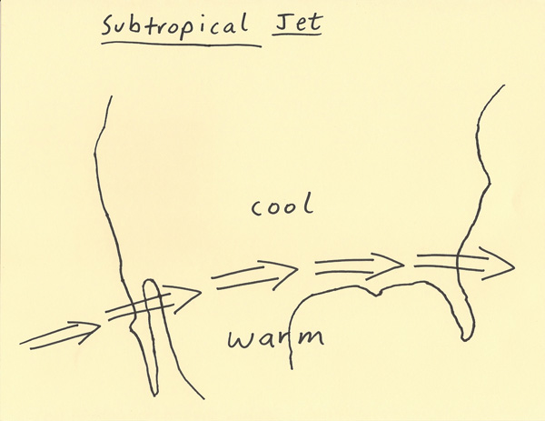
The subtropical jet is a weaker version of the polar jet. It develops in a similar way as the polar jet in that it generally separates large
air masses. Since the air masses being separated by the subtropical jet are not as extreme in temperature as the temperature
difference between the air masses separated by the polar jet, the subtropical jet tends to have weaker wind speeds as compared
to the polar jet. The subtropical jet occurs at lower latitudes as compared to the polar jet and generally separates tropical
air from mid-latitudinal air. Just like with the polar jet, the subtropical jet contributes to precipitation, upper level dynamics,
and cloud cover. The diagram below shows the subtropical jet flowing over the southern portions of North America. The position
and strength of the subtropical jet is important to weather forecasting. It can be analyzed on upper level analysis and model
images such as at 500, 300 and 200 millibars. Since the subtropical jet is flowing from tropical ocean regions, it can transport
a significant amount of moisture into the continent. This moisture and the upper level dynamics resulting from the jet
can bring precipitation into regions it flows over.
|
|
|