
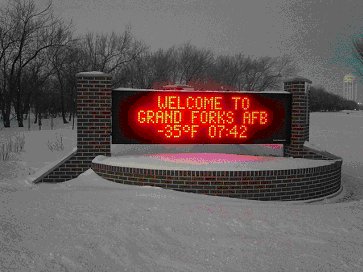
 The standard ingredients necessary to qualify for a blizzard, according to both the United States Air Force Weather Agency and the National Weather Service (sometimes varies), are surface wind speeds of at least 30 knots (35mph), surface visibility down to predominately Ľ statute mile or less and needs to be sustained for a period of at least 3 hours. Generally blizzards can be expected anywhere between the months of November through March. The two primary synoptic scale weather regimes responsible for producing mesoscale blizzard and near-blizzard conditions at Grand Forks Air Force Base are the Colorado Low and the Alberta Low. Alberta Lows tend to travel much faster in relation to the Colorado Low due largely to the mean orientation of the Polar Front Jet during winter, and are therefore very dangerous because of the speed of their onset. Colorado Lows usually generate more snowfall and greater property damage due to their slower movement and greater accessibility to Gulf moisture. Three main considerations when contemplating a blizzard forecast are the strength of the winds, the intensity of expected snowfall and pre-existing conditions. Climatologically, Grand Forks has usually been within 300 miles or closer to the low-pressure center and on the left side of the storm track during blizzard events. The west to northwest periphery of these deepening systems usually contains an intense pressure gradient force that drives the strong winds in the system. An "open" Gulf of Mexico moisture source is often a major player in providing sufficient moisture to produce enough snow to reduce visibility for a prolonged period. Surface shortwave troughs circulating around the system provide low-level convergence while upstream upper-level lows or short waves assist in dynamic lifting. One of the most crucial factors in determining if blizzard conditions will be met or not is the character of the falling snow and/or any pre-existing snow on the ground. Fine snow that contains little moisture will remain suspended in the air much longer, and resist sticking to the ground as compared to larger, wetter snowflakes. Fresh snow will blow or drift in temperatures of -4° F or less, but after a couple of days it will begin to crust due to exposure to direct sunlight. In addition, snow that has been previously exposed to strong wind events and has already been blown around will be less effective in reducing visibility (Mireles, Pederson, and Elford 5). As an additional aggravating factor, Grand Forks AFB and the surrounding region have a very flat terrain and few trees or other natural obstructions to inhibit the momentum of blowing snow. Although many people associate North Dakota with miserably, blustery winters filled with numerous blizzards, the actual occurrence of all the parameters that qualify a blizzard are not met very often. Out of the nearly 40 Colorado Lows that cross the plains each winter, less than four produce blizzard conditions on average. Further, Alberta Lows only produce one or two blizzards annually from the over 40 that pass the Dakotas and Minnesota. Surprisingly, North Dakota only endures slightly more than two blizzards per winter on a historical average (USGS). Just because blizzards are rare animals, does not mean they don't pack a punch. Blizzards are potentially very dangerous storms and should never be taken lightly. In an average year, as many people are killed by blizzards as die during tornadoes (Abbott 282). The majority of these deaths can be attributed to heart attacks suffered by people shoveling and dealing with the heavy snowfall, traffic fatalities, walkers losing traction on slick surfaces and people getting lost and freezing to death. Blizzards can also amass a staggering amount of property damage. In "The Great Blizzard of 1978," an estimated $600 million in losses of property occurred in the Rhode Island and Massachusetts areas (Vasquez 38). In 1997, a severe blizzard that dumped over 20 inches of snow over the City of Grand Forks contributed to the worst flooding the town has ever seen and caused over 5,000 people to seek shelter at the air base. Blizzards will also cripple almost all aviation operations. It is paramount that an Air Force forecaster provides sufficient notification to base leadership prior to a blizzard event so proper precautions can be taken. The standard Air Force desired lead-time for a blizzard warning is 90 minutes. A blizzard watch is issued any time the potential exists, and may be issued days before the event is expected. A blizzard can rapidly drop conditions to well below Instrument Flying Rules and airfield minimum weather requirements, essentially shutting down all flying operations. An accurate blizzard forecast helps the base civil engineering department ensure there are enough personnel available to remove snow from taxiways and runways. On the advice of the base weather station, the base commander determines the need for delayed or cancelled reporting to duty of non-storm-essential personnel, or early release to minimize the great risk associated with driving in blizzard conditions. The inherent statistical difficulty in forecasting a blizzard lies in deciding which one out of about 70 to 80 winter low pressure systems will produce blizzard criteria. Rules of thumb and current prognostic models are increasingly improving the accuracy of wind and precipitation intensity predictions, but there are not many hard and fast rules or applications available that a forecaster can use for blizzards. The forecaster must rely heavily upon regime based forecasting, local climatology and personal experience dealing with these winter events. In many instances, visibilities will not be reduced enough for the entire period, or winds will not maintain 30 knots or more and "near blizzard" conditions will result. The high degree of variability in the physical properties of the snow make it almost impossible to accurately forecast how the visibility will be reduced until the storm plays out. It is difficult to locate any detailed research into blizzard forecasting. Perhaps further research is not conducted because it is generally not difficult to identify the potential for blizzard conditions. The National Weather Service does well in alerting the public to winter storm watches, warnings and advisories. Further investigation and analysis of snow physics combined with advancing model data and the inclusion of local terrain features would most likely enable the creation of a blizzard threat-assessment tool, but perhaps it is not cost effective enough to do so. In any event, ever advancing computer technology, radar and satellite imagery facilitate identification of upstream blizzard producing systems. It can be particularly unpleasant to be stuck outdoors in a blizzard with wind chill temperatures cooler than -30° F, near zero visibility and winds in excess of 35mph. While today's blizzards pose little more than an inconvenience to North Dakotans, early pioneers were terrified of them because of the swiftness of their arrival, often stranding them in the open country unable to navigate in the whiteout conditions. The future can only hold improvements for accurately predicting these nasty winter storms and people will be better informed of their impending arrival. 1997 Blizzard "Hannah" at the University of North Dakota 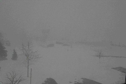 IR Satellite Imagery of Blizzard "Hannah" (courtesy RWIC) 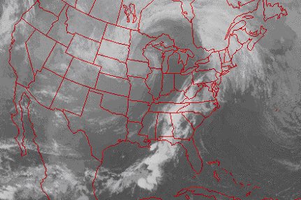 Works Cited Abbott, Patrick. Natural Disasters. 4th. New York, NY: McGraw-Hill, 2004. Mireles, Mark, Kirth Pederson, and Charles Elford. AFWA TN-98/002 Meteorological Techniques. 13th. Offutt Air Force Base, NE: USAF, 2007. Regional Weather Information Center, "The Blizzard of 1997." 1997. University of North Dakota. 23 Mar 2007 http://www.rwic.und.edu/blizzard97/ USGS, "Climate of North Dakota-Blizzards." Northern Prairie Wildlife Research Center. 03 Aug 2006. United States Geological Survey. 20 Mar 2007 http://www.npwrc.usgs.gov/resource/habitat/climate/blizzard.htm Vasquez, Tim. Extreme American Weather. 1st. Austin, TX: Weather Graphics Technologies, 2004. |