
On January 26, 2004 freezing rain occurred over much of South Carolina. Below is a radar image from around noon on this date showing the freezing rain over that area. 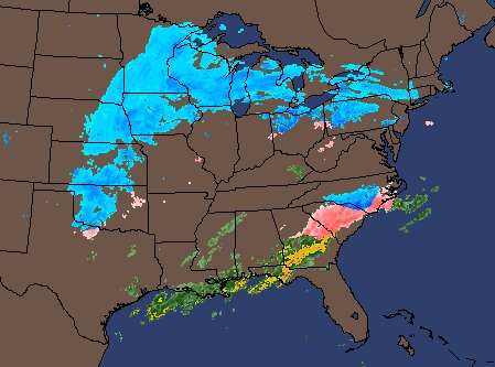 Freezing Rain is liquid precipitation that reaches the surface in the form of drops that are greater than 0.5 millimeters in diameter. The drops then freeze on the earth's surface. The temperature profile in a freezing situation is such that temperatures are warm enough aloft for the precipitation to be all rain. This rain then falls into a shallow layer of colder air near the surface. If surface objects are at freezing or below, the liquid precipitation will freeze. The temperatures at 850-mb over South Carolina are around 10 C (50 F). The precipitation is well above freezing as it is falling at that pressure level. In this situation there is a shallow layer of cold air at the surface. This cold air came from polar air advecting in from the north and damming up against the Appalachian mountains. This is termed a cold air damming situation. The cold air is shallow and dense. Dense shallow air will resist flowing toward higher elevations. The heavy air filters to the lower elevations. The temperature at the surface is below freezing over much of South Carolina. Thus, the rain aloft will freeze once it reaches the surface. The next images are that of soundings out of Charleston, SC and Atlanta, GA. Notice the shallow cold air near freezing at the surface and much warmer temperatures above this layer. 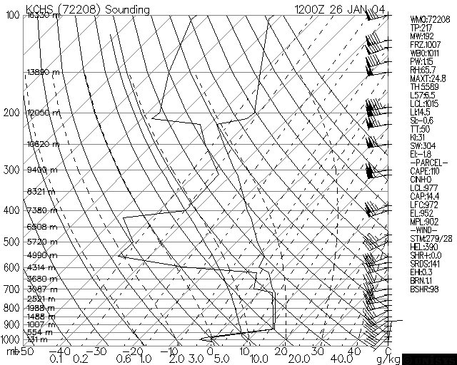 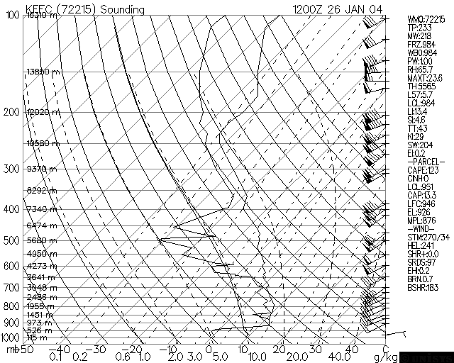
|