
A cold front is a boundary that separates cold and warm air masses and the cold air is replacing warmer air. Often, the colder air will be drier than the warm air it is replacing. Thus, cold fronts tend to bring in colder and drier weather.  A developing cold front will often be connected to a developing mid-latitude cyclone. The region of the circulation around the low pressure where air is moving toward lower latitudes will be the area that the cold front develops. Cold fronts can also result when a region of polar or arctic air spills toward lower latitudes. Often the air behind a cold front will be polar air while the air it is displacing will be tropical type air. 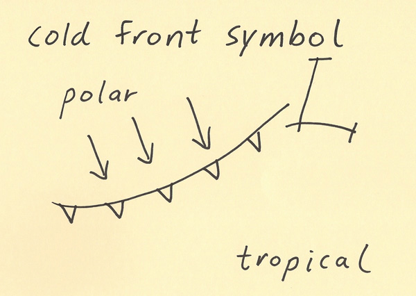 A cold front not only has a surface boundary but it also has an air mass discontinuity in the vertical. The region of colder air tends to deepen with distance behind the surface cold front boundary. The air mass discontinuity is also reflected in a pressure discontinuity. Since colder air is more dense than warm air, the vertical pressure surfaces are closer to each other in cold air while they are spread farther apart in warm air. The pressure discontinuity can result in increasing wind speeds. When precipitation occurs with a cold front, the precipitation is most often located along and ahead of the cold front boundary since the best lifting is near the cold front boundary. While it is not always the case, the weather behind a cold front tends to result in a reduction of precipitation chances. 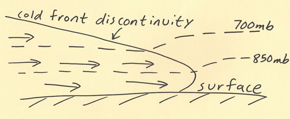 |