
Convective instability is a situation in which the troposphere can be made more unstable due to the lifting of air. This lifting needs to be dynamic lifting (low level convergence, upper level divergence) that causes lifting throughout or most of the troposphere. Convective instability can take an already unstable troposphere and make it even more unstable. Thus, it is an important process to study when it comes to forecasting for severe weather. Generally when the troposphere is unstable there will be warm and humid air in the boundary layer with cold air aloft (or cold and very dry aloft). It is the layer of dry air aloft that is important to enhancing convective instability. When air is lifted, the lifted air will either be unsaturated or saturated. When the air is saturated the air will cool at the wet adiabatic lapse rate which varies but we will say it is around 5 C/km for the purposes of this writing. The air does not cool as much as it could while rising since the heat of condensation from the moisture condensing out of the air is offsetting some of the adiabatic cooling. When the air is not saturated it will cool at the dry adiabatic lapse rate which for the purposes of this writing is about 10 C/km (or about half the wet adiabatic rate). Thus, rising air COOLS MORE when it is unsaturated since there is no condensational warming. An unstable situation is to have warm/moist air near the surface with cold air aloft. If that cold air aloft is dry, then when that air aloft is lifted it will be made even colder. This is how convective instability works. The troposphere is made even more unstable by lifting the layer of air aloft at the dry adiabatic lapse rate to make it even colder. This will decrease the LI and increase the CAPE (in other words making these index values more unstable). 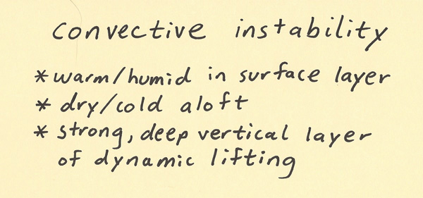 The diagram below is a visual of how the convective instability process works. First, there needs to be lifting that takes place by a dynamic lifting mechanism throughout the troposphere (or at least through a deep layer of the troposphere including where the dry air is aloft). This lifting cools the middle and upper troposphere more than the saturated air rising from closer to the surface. The air aloft in the cold/dry layer is cooling by 10 C/km at the dry adiabatic lapse rate while the air closer to the surface is cooling only by half this much each kilometer of lift. This results in the air in the dry layer cooling at a greater rate than the air closer to the surface. This increases the lapse rate of temperature with height and thus increases the instability. Convective instability can take an unstable troposphere that can support severe weather and make it even more unstable with the ability to support more intense severe weather. 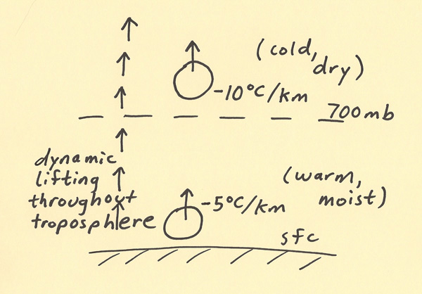
|