
Earth is approximately a sphere. The surface area of a sphere is a curved surface thus a flat planar coordinate grid system does not ideally work when labeling locations on Earth. The system that is used to locate points on the Earth’s surface are the latitude and longitude lines. These lines are curved since they are on the surface of a sphere. The diagram at the bottom shows an example of latitude and longitude lines on Earth. The latitude lines run east-west but measure north-south. A way to remember latitude is that a latitude line does a “lap” around the equator. The word “lap” and “latitude” both starts with “la”. The latitudes make completed circles around the Earth. The largest circle is at the equator. The circles become progressively smaller when moving toward the pole. At the poles the latitude line is just a single point. The lines a latitude are parallel to each other and they do not get closer to each other when divided into equal increments. The lines of longitude run north-south but measure east-west. All lines of longitude pass directly over the poles. They merge toward each other at the poles and are a greater distance from each other at the equator when divided into equal increments. All lines of longitude make the same size circle since they all pass through both poles. Any point on Earth can be labeled by using a value of latitude and longitude. Latitude is the north or south measurement from the equator and longitude is the east or west measurement from a chosen longitude line that passes through Greenwich, England. Thus, latitude and longitude will include two numbers such as 45 N 100 W. The degrees can be divided up into minutes and seconds for greater location accuracy. The minutes and seconds are not related to time units but are rather related to dividing distance into finer increments. 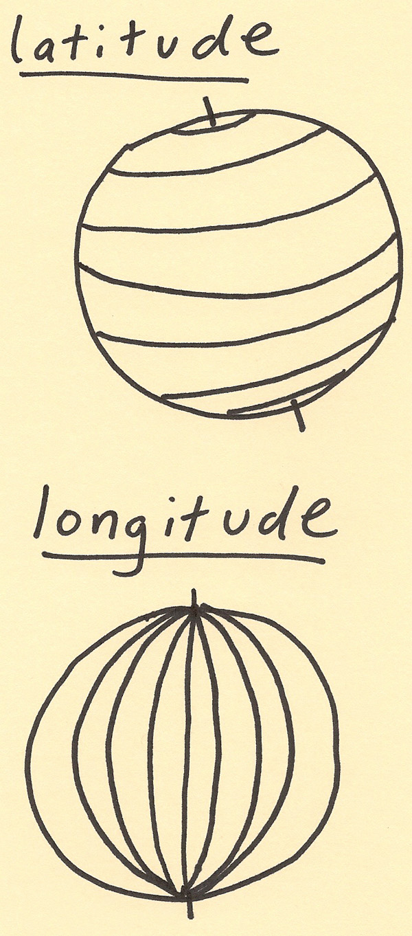 |