
Wind can be both a gift and a nuisance. Wind helps mix the air and disperse polluted air. Wind though can make outside conditions feel more unpleasant as compared to a calm wind. The diagram below shows four processes that can create a strong wind. Each one is explained below. Pressure Gradient: The pressure gradient depends on how much the pressure changes over distance. A rapid change in pressure over distance leads to stronger winds. Wind near a low pressure system or between tightly packed high and low pressure systems can create stronger winds. The spacing of isobars and height contours on a weather map can be used to assess how strong the winds will be. When the spacing is closer then the winds are stronger. Funneling: Funneling occurs when air is forced between a narrow opening. This is very noticeable in an urban area between tall buildings. It also occurs in cases where topography confines the wind through a tight space such as in a valley between mountains. Storm Downdraft: A storm downdraft can produce strong convective wind gusts. A downdraft is produced from rain cooled air in a storm that accelerates toward the ground. Since evaporation cools the air, the downdraft air is generally colder than the surrounding air. This density difference causes the dense downdraft air to accelerate toward the ground. The downdraft is also helped by precipitation particles falling toward the ground. Elevation: Being at a higher elevation can cause the wind to be stronger. This is because there is less friction to slow the air before it collides with higher elevations. Wind generally increases with height due to less friction aloft. Thus, higher elevation regions tend to have an overall stronger wind as compared to surrounding lower elevation regions. 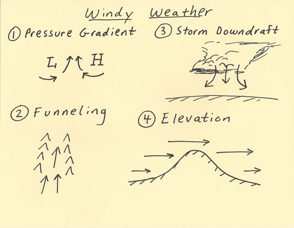 |