
A trapping layer is a stable layer where air stays confined to a certain location or between two pressure levels in the atmosphere. Two types of trapping layers that will be analyzed are a surface trapping layer and a trapping layer aloft. In a surface trapping layer, the air at the surface tends to have little wind speed, is dense and the temperature increases with height within the layer (inversion). This very stable situation prevents the air from mixing. This can lead to low air quality when the inversion is long lasting. Clouds aloft can help prolong the trapping layer since sunlight is not able to warm the surface to help mix out the layer. These type of trapping layers are more common in winter when the sun angle is low in the sky, days are short and cold dense air is more widespread. Valleys can be natural locations for this to occur since cold dense air sinks into the valley. The mountain slopes and clouds prevent sunlight from reaching the valley which can lead to long periods of time with stagnant air. Air can also become trapped between two layers aloft as shown in the second diagram below. This can occur when air is forced lifted over mountains or is forced lifted/convectively lifted and then moves downwind into stable air. In these cases the air overshoots and undershoots an equilibrium elevation. An analogy is creating a wave along a rope that propagates down the rope. 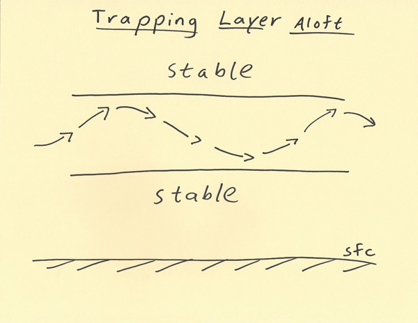 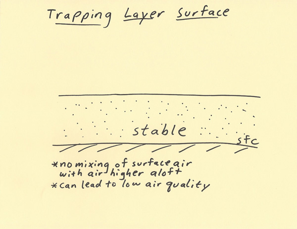 |