
METEOROLOGIST JEFF HABY
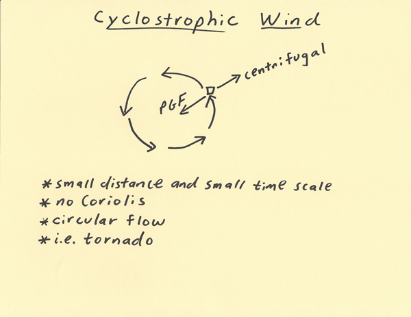
The cyclostrophic wind differs from the gradient wind in that the Coriolis force is not involved. The Coriolis force requires long time periods
(hours) in order to become firmly established. Rotations that occur in the time scale of minutes or less will not be significantly influenced
by Coriolis. The cyclostrophic wind is a balance between the Pressure Gradient Force (PGF) and the outward fleeing centrifugal force. A
cyclostrophic wind also tends to have a “tight” curvature compared to curvatures within troughs and ridges. This occurs since the wind
motion is not only over short time scales but also over much shorter distance scales. Examples of cyclostrophic weather events include
circulations within thunderstorms, tornadoes and wind eddies. A cyclostrophic circulation can result in a brief but rapid drop in
surface pressure due to the rising motions these circulations can produce.
|
|
|