
METEOROLOGIST JEFF HABY
When examining radar images, it is common to see storms grouping together into lines and/or clusters. One reason for this is due to
a common forcing mechanism. Examples of forcing mechanisms include fronts, dry lines, a low level convergence axis, upper level
divergence and warm air advection. Since forcing mechanisms commonly have an axis and/or area with the greatest uplift, naturally
storms will form on these axes and/or within the region of greatest uplift. Another reason storms tend to form in bands and clusters
is that the first storm(s) to develop will produce outflow boundaries. These outflow boundaries are like mini fronts that enhance
lifting around them. Thus new storms will often develop in the vicinity of storms that have already developed.
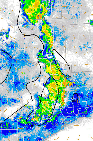
It is common to see linear bands of strong storms since these storms are developing along a common low level convergence boundary. The
storms within the band will move in a similar direction since the middle and upper level winds help steer the storms. The radar image
below shows examples of lines and clusters of storms. Typically the heavier precipitation (darker oranges in sample) is along the
leading edge of storm motion where convergence is maximized. Thus many times the heaviest precipitation will occur when the storm
first moves through.
|
|
|